Tuya and volcanic neck, Oregon
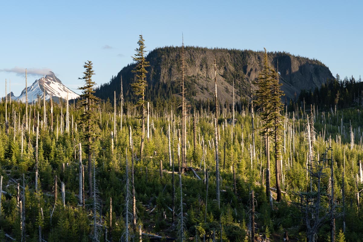
Hayrick Butte, a tuya (a flat-topped volcano that erupted through thick glacial ice) and Mt. Washington, an eroded volcanic neck in the HIgh Cascades of Oregon. (250618-66)
Download ImageMt. Washington, an eroded volcanic neck, OR
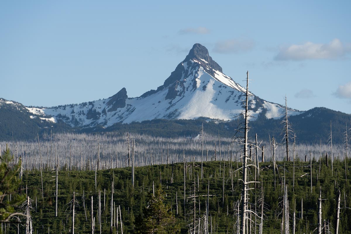
Mt. Washington, an eroded volcanic neck in the HIgh Cascades of Oregon. Dead trees from the 2003 B&B Complex wildfire, stand in the foreground. (250618-37)
Download ImageBlack Butte cone, Oregon
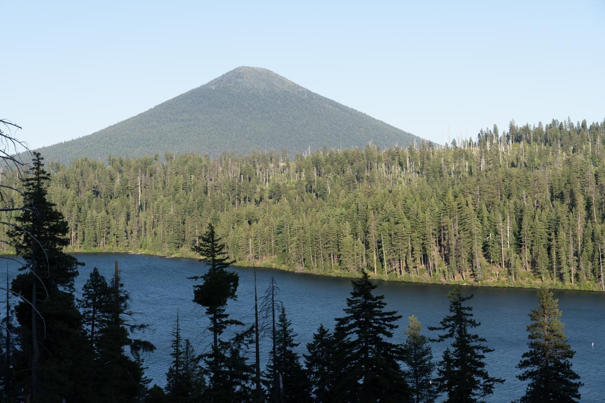
Black Butte, a symmetrical volcanic cone in the HIgh Cascade Range of Oregon. Suttle Lake in the foreground. (250618-31).
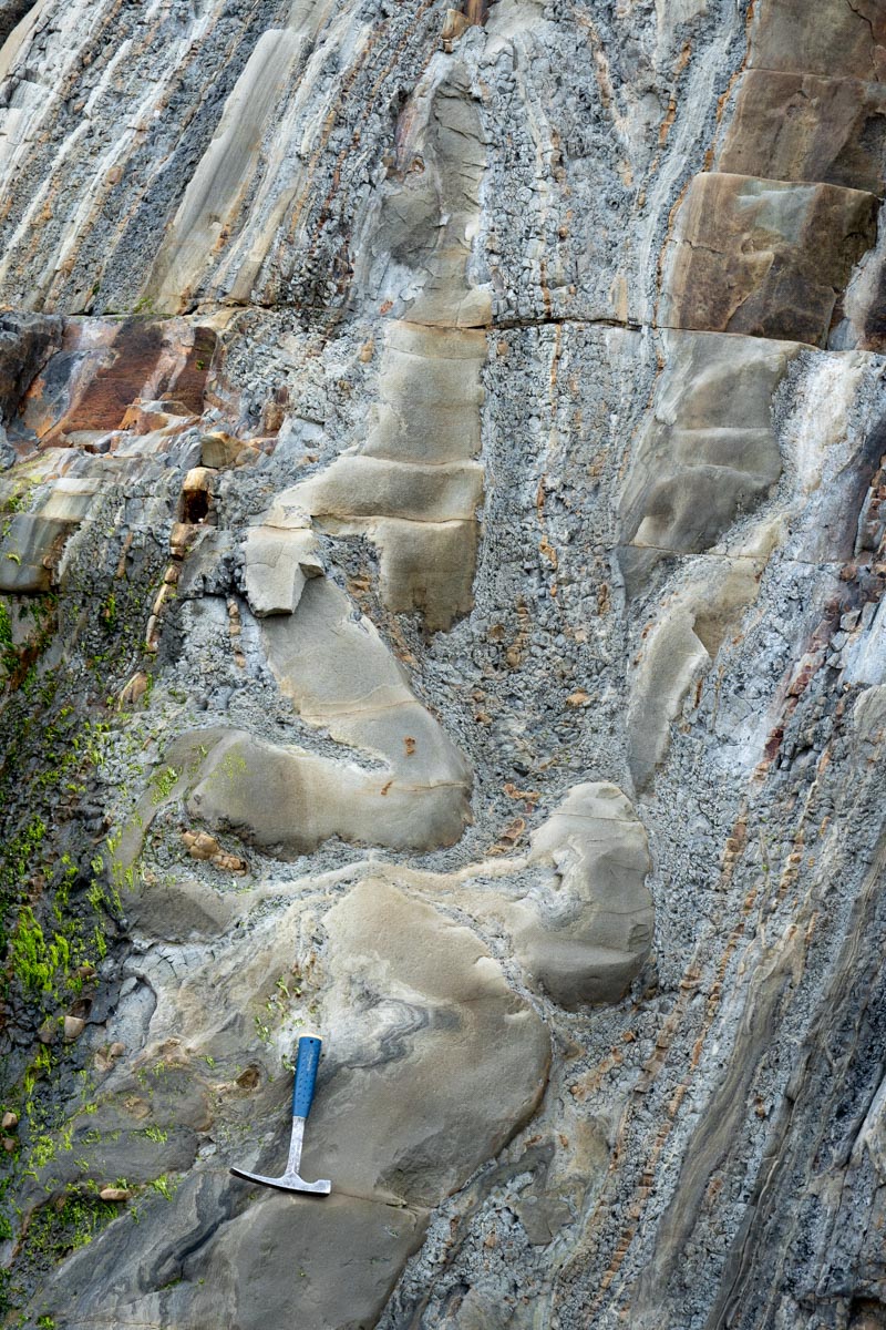
Download ImageFlame and load sed structures, Oregon
Flame structures, load casts, and graded beds in Eocene sandstone and shale of the Coaledo Formation, Oregon. Top to left. (250324-5)
Download ImageFlame and load sed structures (vertical)
Flame structures, load casts, and graded beds in Eocene sandstone and shale of the Coaledo Formation, Oregon. Top to left. Photo is about 40 cm from left-to-right. (250324-3)
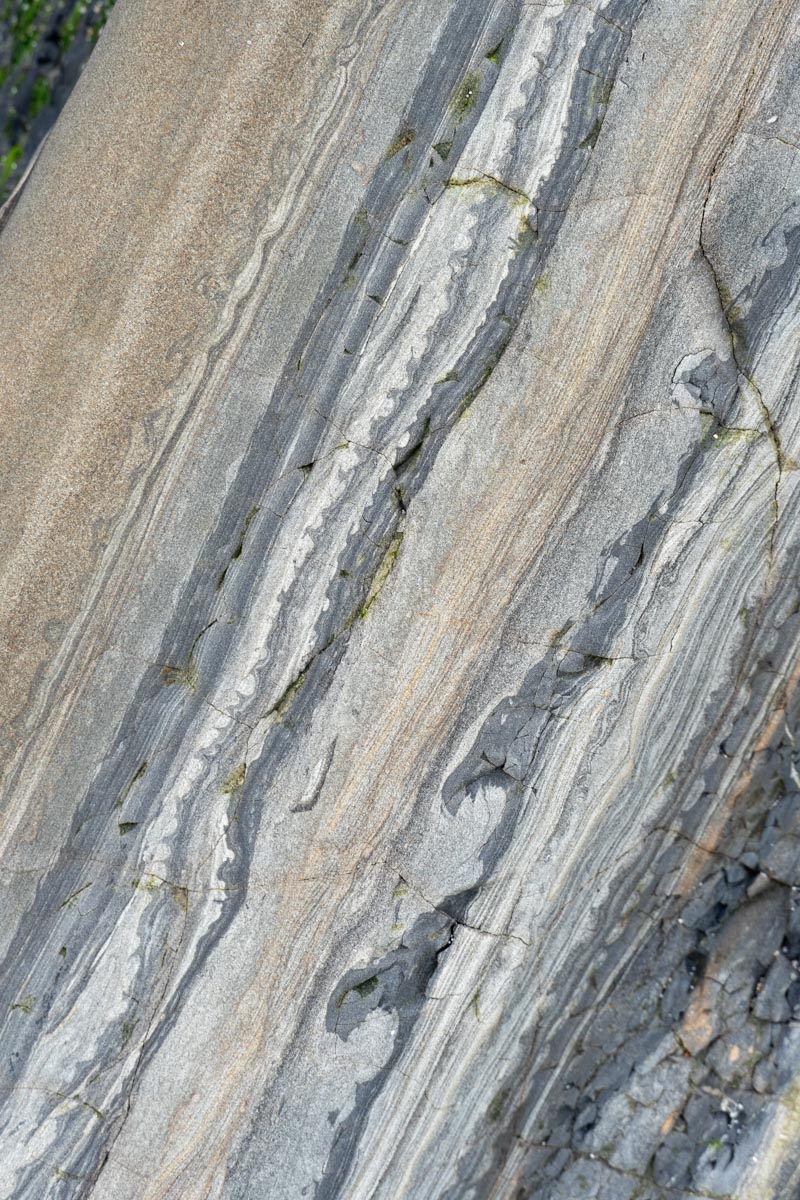
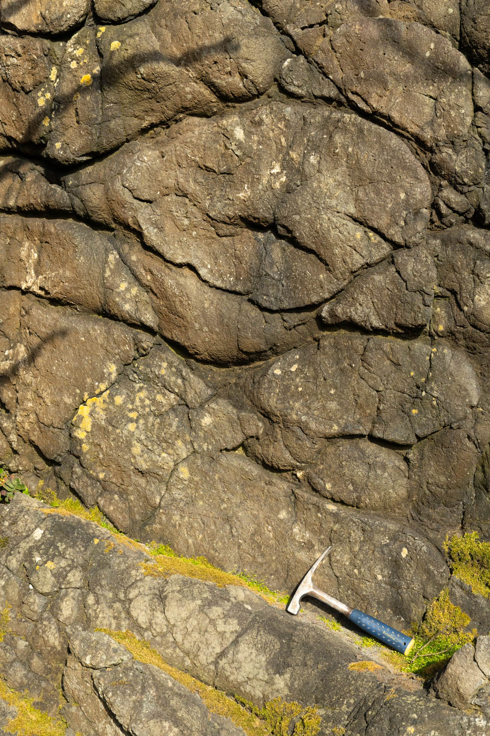
Download ImageSoft-sediment deformation (vertical)
Soft-sediment deformation in sandstone and shale of the Eocene Coaledo Formation, Oregon. (250324-1)
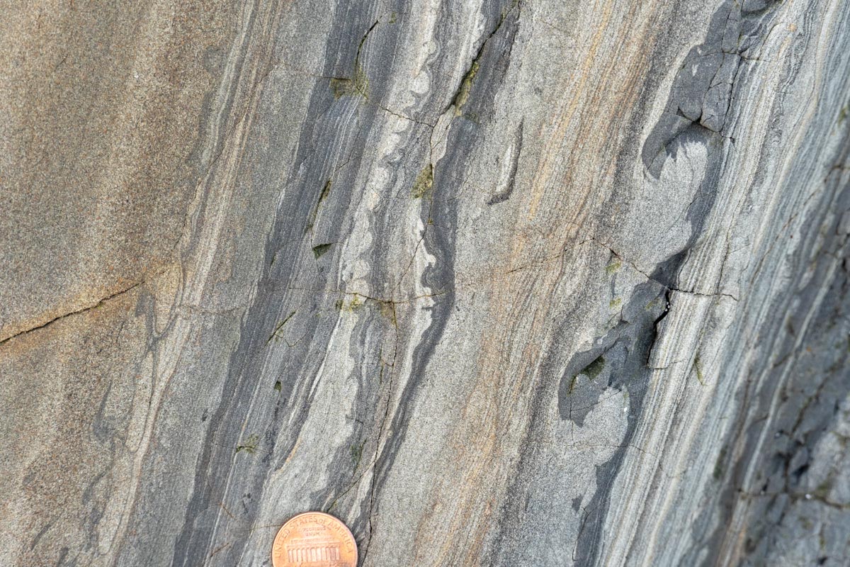
Download Imagetilted fault block, SE California
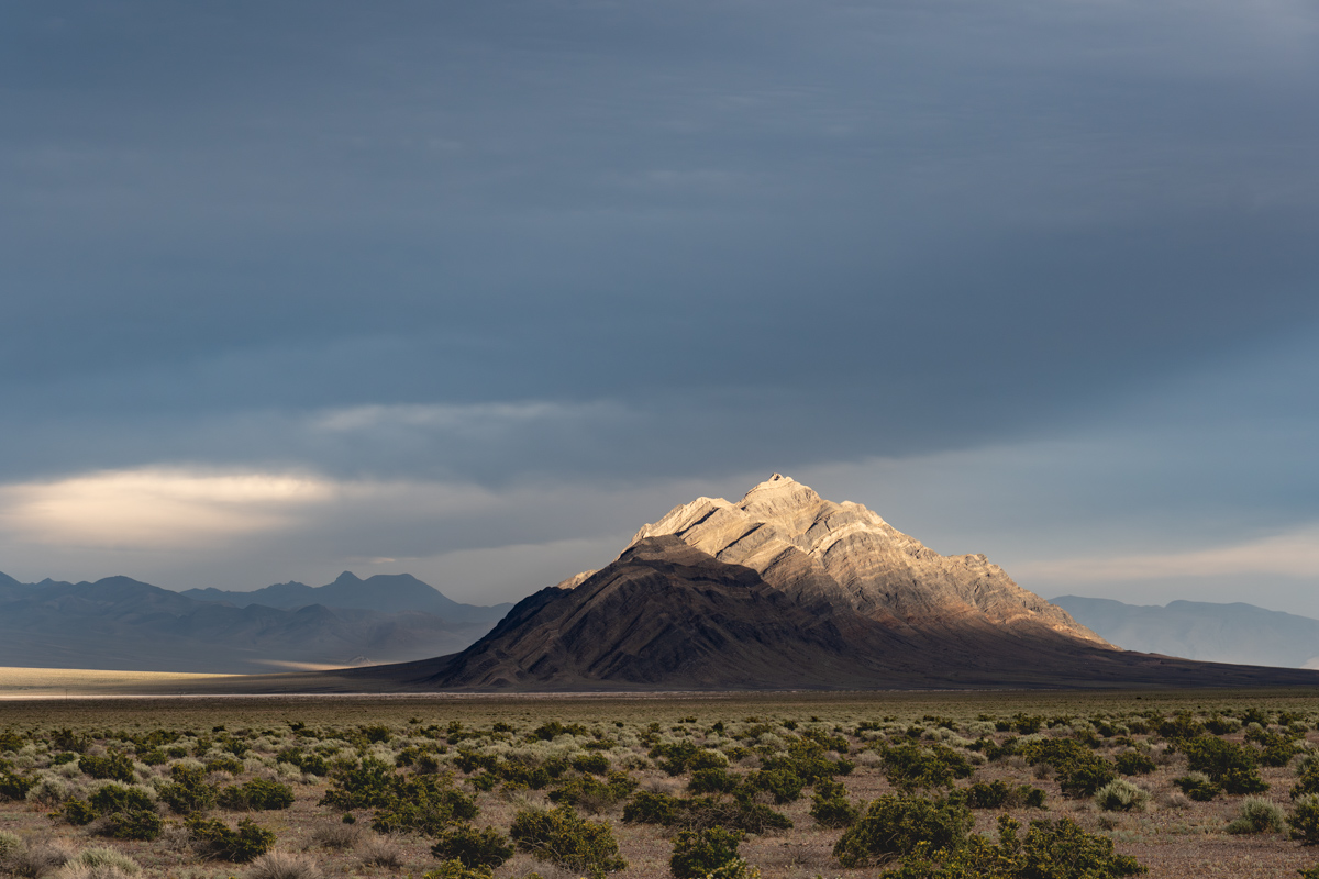
Eagle Mountain, a tilted fault block of Cambrian sedimentary rock, Amargosa Valley, California (250504-45)
Download ImageMt. St. Helens, WA
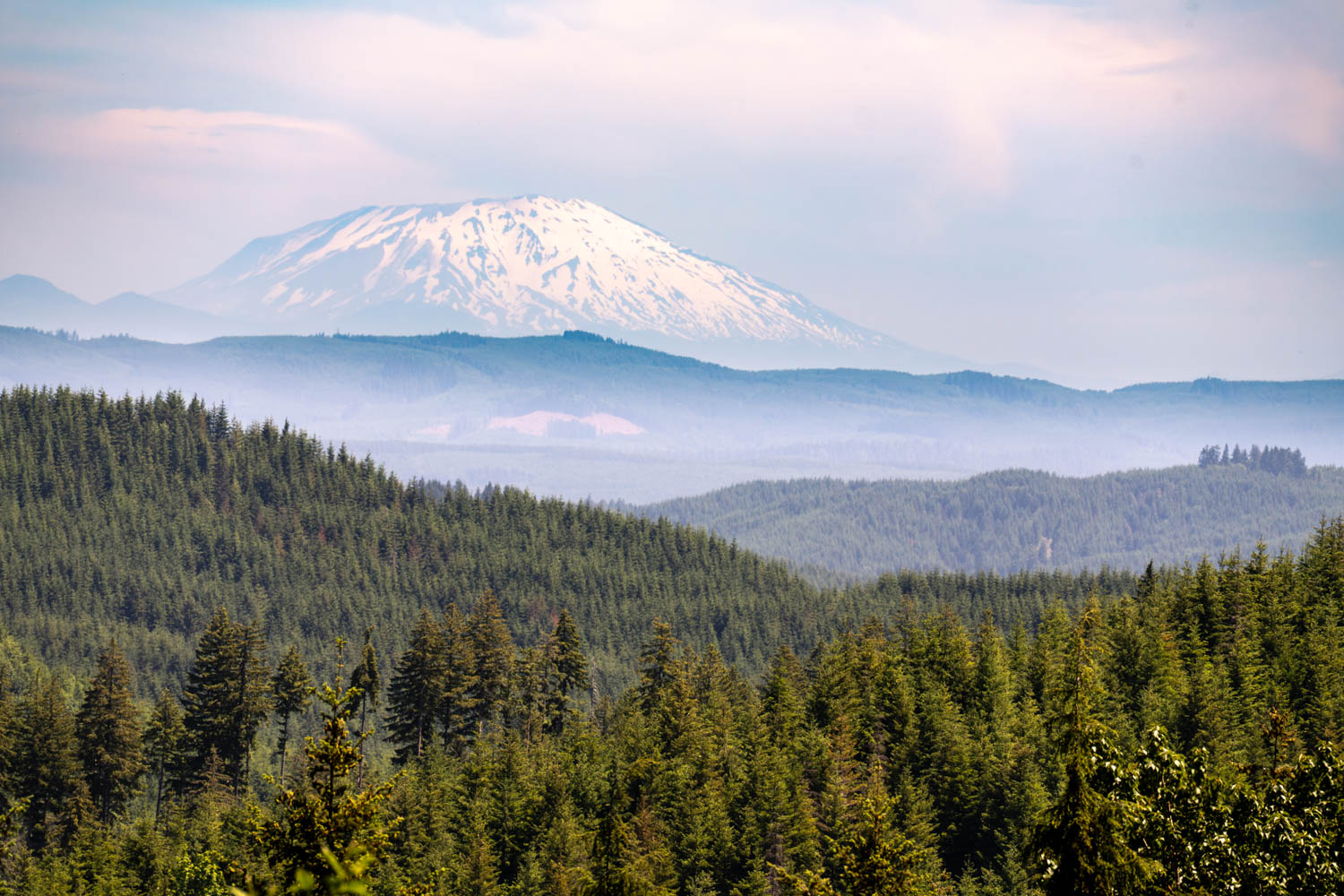
Mt. St. Helens stratovolcano, Washington, as seen from the Oregon Coast Range (250610-51E)
Download Image
Pillow basalt, WA
Pillow basalt of the accreted Eocene Crescent Formation (Siletzia), Cape Disappointment State Park, Washington (250610-11)
Download ImageBreaking wave, WA
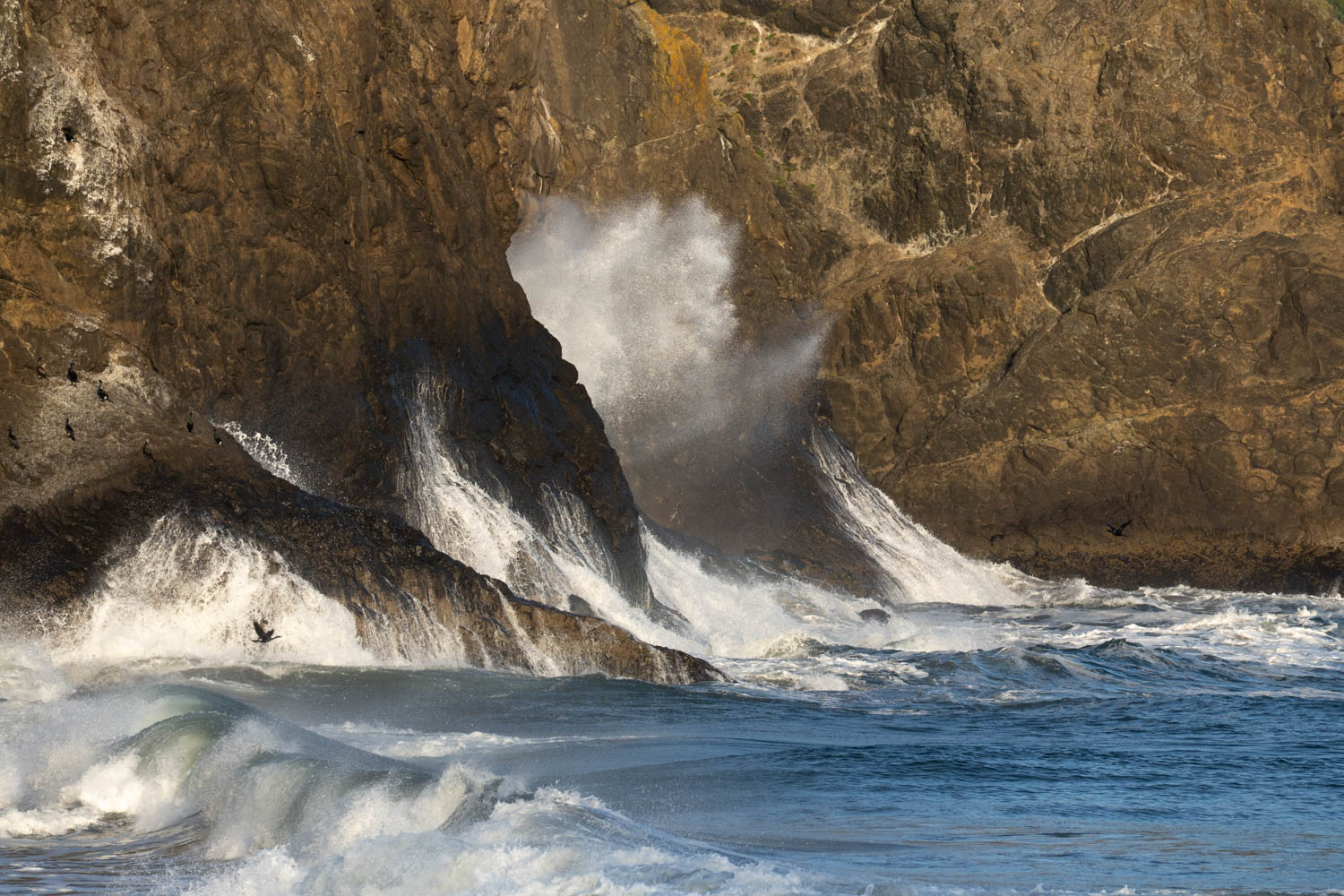
Waves breaking on headland, Cape Disappointment State Park, Washington (2506099-31)
Download ImageBreaking wave, WA
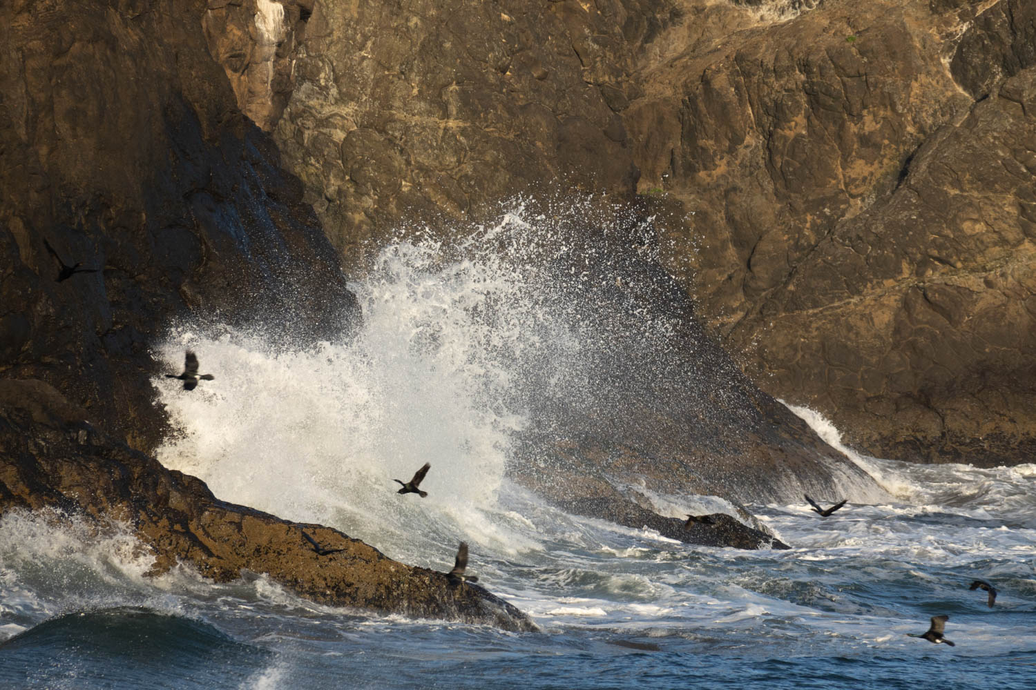
Waves breaking on coastal headland, Cape Disappointment State Park, Washington (250609-28)
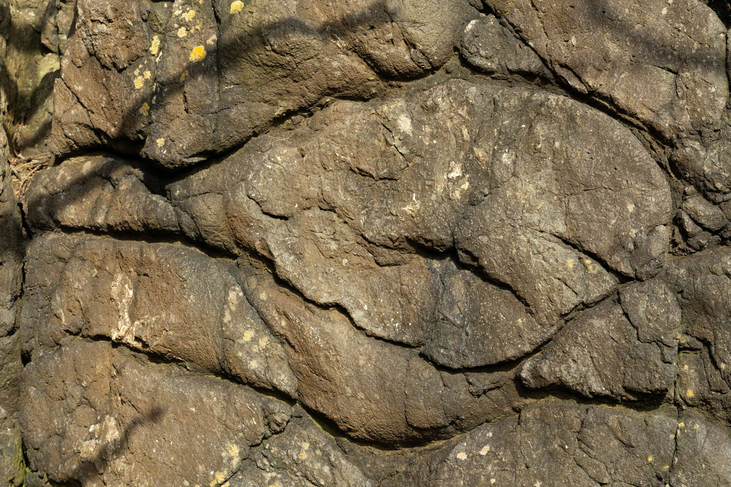
Download ImageSiletzia pillow basalt, WA (vertical)
Pillow basalt of the accreted Eocene Crescent Formation (Siletzia), Cape Disappointment State Park, Washington (250609-23)
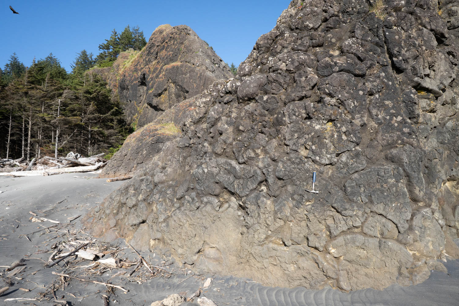
Download ImageSiletzia pillow basalt, WA
Pillow basalt of the accreted Eocene Crescent Formation (Siletzia), Cape Disappointment State Park, Washington (250609-20)
Download ImagePillow basalt, WA (vertical)
Pillow basalt of the accreted Eocene Crescent Formation (Siletzia), Cape Disappointment State Park, Washington (250609-15)
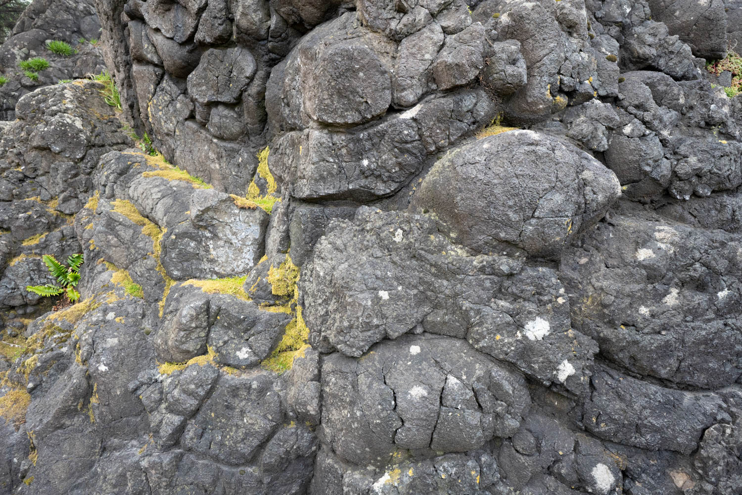
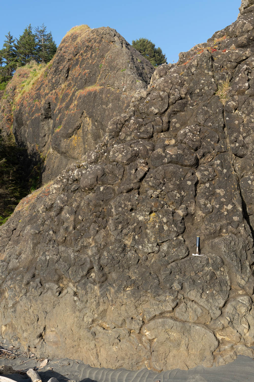
Download ImagePillow basalt, WA
Pillow basalt of the accreted Eocene Crescent Formation (Siletzia), Cape Disappointment State Park, Washington (250609-14)
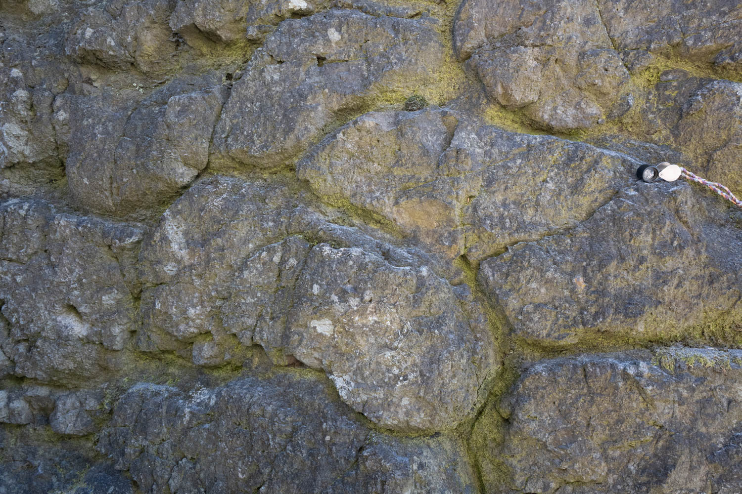
Download ImagePillow basalt, WA
Pillow basalt of the accreted Eocene Crescent Formation (Siletzia), Cape Disappointment State Park, Washington (250609-5)
Download ImageMt. Rainier, WA
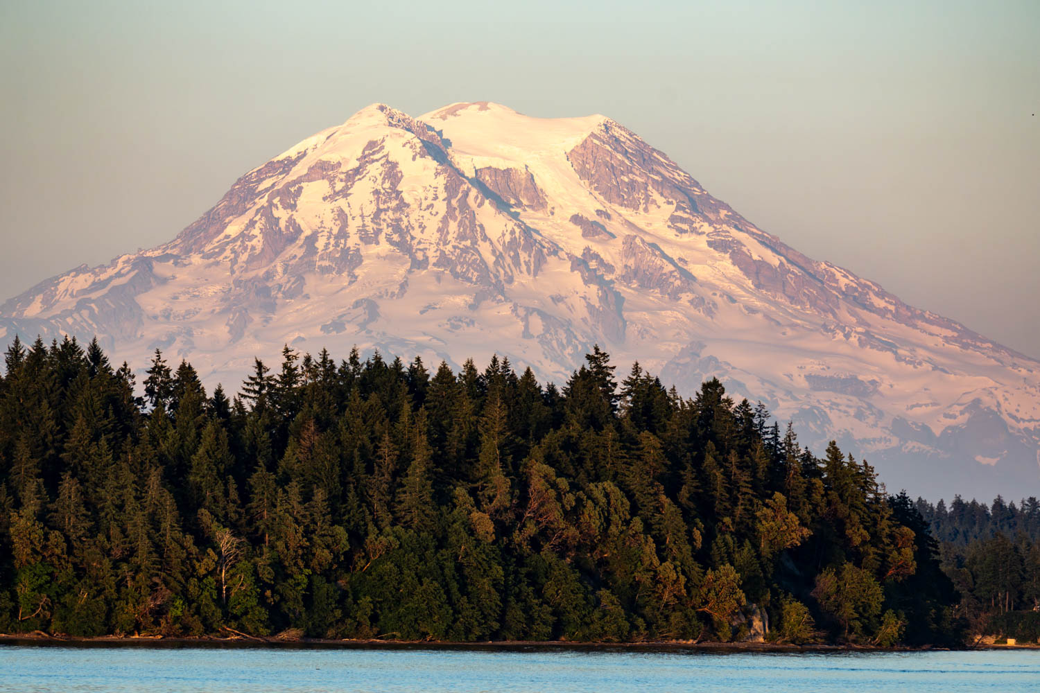
Mt. Rainier stratovolcano, from Carlyon Beach, southern Puget Sound, Washington (250608-82E)
Download ImageGrande Ronde Basalt in quarry, OR
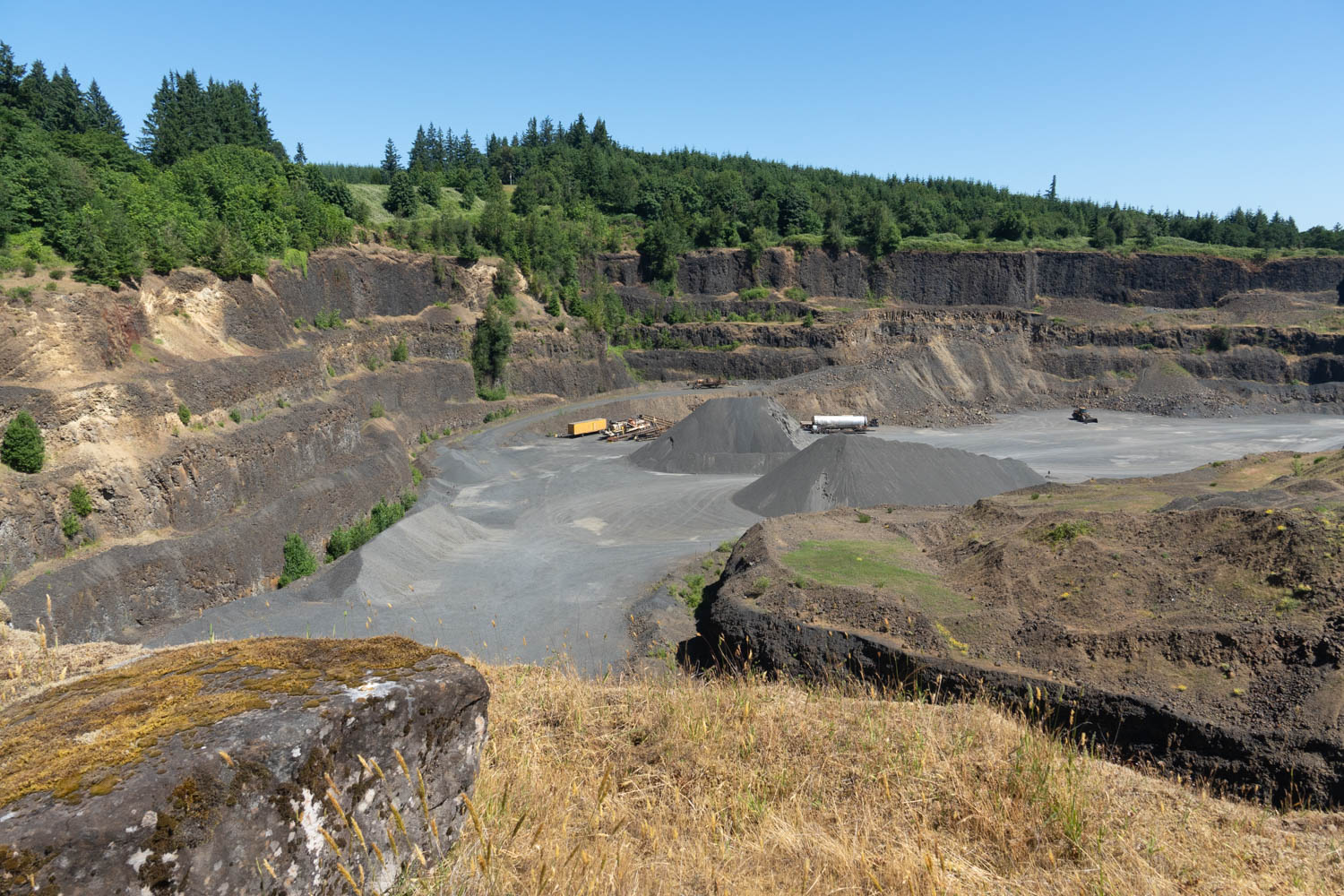
Quarry exposing flows of the Grande Ronde Basalt of the Columbia River Basalt Group, St. Helens, Oregon (250608-17)
Download ImageDipping Miocene strata
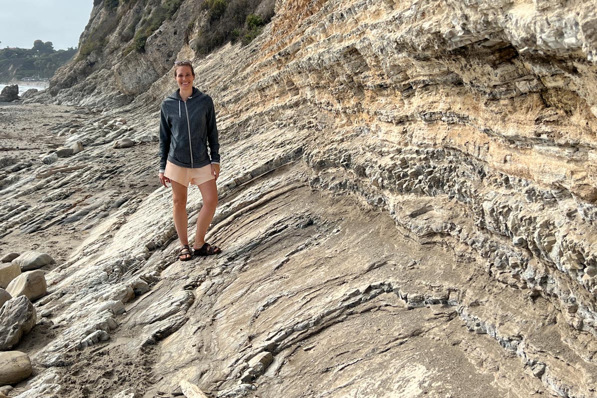
Dipping non-folded beds of Miocene siltstone of the Monterey Fm, California. Photo accompanies IP2408-5881, which looks like a fold but is just a different view.(IP2408-5883)
Download ImageApparent dip in Miocene strata
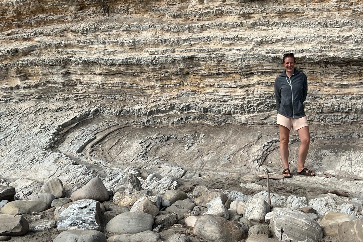
Dipping non-folded beds of Miocene siltstone of the Monterey Fm, California. An example of issues with apparent dip. See photo IP2408-5883 to see a different angle.(IP2408-5881)
Download Image